Our Lake is gonna flood!

Here you can discuss Chrysler Sailing across all makes of Chrysler sailboats.
Post Reply
User avatar
Bhacurly
Posts: 754
Joined: Tue Nov 08, 2005 10:06 am
Location: Spokane WA

Our Lake is gonna flood!

Post by Bhacurly »

Well,

Talked with the marina owner the other day, our snow pack is still 165% of normal and it was snowing when we were talking,,, looks like the lake could be 4 ft over the normal level come June if the pack melts too fast!! The Clark Fork River drains into the lake and is a big river, comes out of Montana way up past Missoula, a large drainage...

It could be up into the parking lot and almost knee deep there if it gets bad. Apparently the docks would be ok, but the walkway to the marina may have to be pulled off, the power box to his office/store taken out, the sewer in town would quit working. We could take the kayak to the boat and go sailing, but would have to watch for lots of debris in the water.

So now I'm hoping it stays cool! Rain is forecast all weekend, with a high of 70 on Tuesday! We've talked of pulling the boat out just in case but will watch for now an see how it goes.

All the smaller lakes and creeks are high as the warm weather approaches finally, could be messy for lots of folks in the next few weeks!

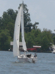
But I'm goiling sailing today and hope to get my new main this weekend also! :D

Billy
User avatar
Capt. Bondo
Posts: 713
Joined: Thu Aug 20, 2009 8:08 am
Location: Hudson, WI

Post by Capt. Bondo »

I can relate, the St. Croix is still close to flood stage and may of the boat launches are still closed with water in the parking lots.
The size of some the logs that we have seen floating down stream could realy cause some damage if you hit one or if it got tangled on a dock or moring line.
Good Luck
H:)ppy Place
78 Chrysler 22

You can go to a Zen Master or you can go Sailing, either way you end up in about the same place..... a Happy Place
User avatar
lecker68
Posts: 1095
Joined: Mon Aug 25, 2008 6:44 pm
Location: Catskill, NY

Post by lecker68 »

I can relate too Hudson river at high tide here at full moon was 4' higher and debris all over they have the dock in but so much debris I cannot get to the deep side.
Catch the wind and ride the wave, Have fun
Lyle
1980 C-26 #1100
S/V My Getaway
http://www.flickr.com/photos/34432376@N06/
User avatar
CaptainScott
Site Admin
Site Admin
Posts: 3112
Joined: Wed Sep 24, 2008 10:46 am
Location: Washington State
Contact:

Post by CaptainScott »

Oh great Billy, and you want me to bring Lady Jo over there?

Maybe you should come here instead! LOL!
Scott
User avatar
EmergencyExit
Site Admin
Site Admin
Posts: 2954
Joined: Wed Dec 10, 2003 5:02 pm
Location: Mississippi Gulf Coast

Post by EmergencyExit »

Down my way..sure go ahead, send us more melting snow.. :wink:

THE FLOOD WARNING CONTINUES FOR THE MISSISSIPPI RIVER AT NATCHEZ * UNTIL FURTHER NOTICE. * AT 12:00 PM FRIDAY THE STAGE WAS 53.8 FEET. * MODERATE FLOODING IS OCCURRING AND RECORD FLOODING IS FORECAST. * FLOOD STAGE IS 48.0 FEET. * FORECAST...THE RIVER WILL CONTINUE RISING TO NEAR 64.0 FEET BY SUNDAY MORNING MAY 22ND.

THIS CREST EXCEEDS THE FLOOD OF 1937 BY 6.0 FEET... THE FLOOD OF 2008 BY 7.0 FEET...THE FLOOD OF 1973 BY 7.3 FEET... AND THE FLOOD OF 1927 BY 7.4 FEET.

* IMPACT...AT 56.0 FEET...SOUTH OF NATCHEZ...BOURKE ROAD IS UNDERWATER. RESIDENTS WILL HAVE TO BOAT INTO THEIR HOMES. ALL HOMES IN THE TOWNSHIP OF FORT ADAMS ARE FLOODED. *

IMPACT...AT 55.5 FEET...RESIDENTS AT THE END OF PERCY CREEK SAND ROAD ARE DENIED ACCESS TO THEIR HOMES DUE TO HIGH WATER. *

IMPACT...AT 55.0 FEET...IN FORT ADAMS POND ROAD IS FLOODED. EIGHT TO ELEVEN HOMES ARE UNDER WATER IN THE TOWNSHIPOF FORT ADAMS. BOURKE ROAD IS FLOODED. *

IMPACT...AT 53.0 FEET...SOME CAMPS AND HOUSES ARE FLOODED AROUND FORT ADAMS.

And this even with 30% of the normal river flow being diverted below Natchez year round at the Old River Control Structure !!
User avatar
EmergencyExit
Site Admin
Site Admin
Posts: 2954
Joined: Wed Dec 10, 2003 5:02 pm
Location: Mississippi Gulf Coast

Post by EmergencyExit »

Here's an interesting figure I just found. In 1997 at Natchez when the Mississippi was 8 feet over flood stage the flow of the water was about 2,000,000 cubic feet per second.

That would fill the New Orleans Superdome in one second..
up for some kayaking anyone ?? lol.

http://pubs.usgs.gov/of/2002/of02-206/e ... agery.html
Post Reply