gps
-
blu by you
- Posts: 67
- Joined: Thu Jun 30, 2011 7:13 am
- Location: land o lakes florida
gps
starting to think about what electronics will be best (gps etc) any advise, cost is a factor mama getting upset about boat costs
im a new chrysler c 22 owner (bought it the end of may )i will be sailing out of port ritchie fl
-
CaptainScott
- Site Admin

- Posts: 3112
- Joined: Wed Sep 24, 2008 10:46 am
- Location: Washington State
- Contact:

This is about the best you'll ever need for most cruising.
This is the unit I'm going with. Just my opinion.
http://www.westmarine.com/webapp/wcs/st ... sNum=10270
This is the unit I'm going with. Just my opinion.
http://www.westmarine.com/webapp/wcs/st ... sNum=10270
"The pessimist complains about the wind; the optimist expects it to change; the realist adjusts the sails." - William Arthur Ward
jerecaustin.com
jerecaustin.com
We have a Garmin 72H and it works great. Price was $150, it's the base model marine handheld by Garmin. We bought it for the delivery home and learned how to use it on the ride back. I want to get a 76CX just for the map features that the 72 doesn't have and keep the 72 for a backup. I use it for speed mostly when we are in the intercoastal but have the waypoints programmed for the inlets and bridges to help keep my bearing at night.
That's the one I picked up, Jay. Haven't used it yet so I can't give you any feedback, but I bought it on advice from a friend who is a cartographer for the gumint. 
He has one and we used it to track our way kayaking. He didn't have any marine charts, though. What do you plan to use?
He has one and we used it to track our way kayaking. He didn't have any marine charts, though. What do you plan to use?
Mark
http://s1213.photobucket.com/albums/cc4 ... ew%20C-22/
1975 C-22 currently named Stardust (soon to be "Angela Marie")
http://s1213.photobucket.com/albums/cc4 ... ew%20C-22/
1975 C-22 currently named Stardust (soon to be "Angela Marie")
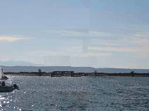
When I last enabled the gps on my phone and I was aboard the Annemarie, google earth said I was in my neighbors driveway, come to think of it, the gps said the same thing the time before? I guess I need to get the hull wet and moving first! I'll start thinking about a gps next year! I like the standard horizon, fishfinder chart plotter combo, my wallet however does not like the $500 +\- price tag!
1976 - C22
"AnneMarie"
"AnneMarie"
I too would love to have an integrated system, Mariner. But my wallet ain't gonna go for it!
Instead, I'm looking at using the data to eventually run on a laptop. We'll see.
Instead, I'm looking at using the data to eventually run on a laptop. We'll see.
Mark
http://s1213.photobucket.com/albums/cc4 ... ew%20C-22/
1975 C-22 currently named Stardust (soon to be "Angela Marie")
http://s1213.photobucket.com/albums/cc4 ... ew%20C-22/
1975 C-22 currently named Stardust (soon to be "Angela Marie")
-
sauerleigh
- Posts: 287
- Joined: Mon Apr 05, 2010 3:50 pm
- Location: Ohio
The PN-40 looks like a nice deal, especially with the maps and imagery!
Mark
http://s1213.photobucket.com/albums/cc4 ... ew%20C-22/
1975 C-22 currently named Stardust (soon to be "Angela Marie")
http://s1213.photobucket.com/albums/cc4 ... ew%20C-22/
1975 C-22 currently named Stardust (soon to be "Angela Marie")
I like the Garmin 441c but the wallet says no
Catch the wind and ride the wave, Have fun
Lyle
1980 C-26 #1100
S/V My Getaway
http://www.flickr.com/photos/34432376@N06/
Lyle
1980 C-26 #1100
S/V My Getaway
http://www.flickr.com/photos/34432376@N06/
This is a repost from a previous thread:
viewtopic.php?t=2301&highlight=polar+navy
I have since switched to software from polar navy, I like it much better.
viewtopic.php?t=2301&highlight=polar+navy
I have since switched to software from polar navy, I like it much better.
1976 - C22
"AnneMarie"
"AnneMarie"
-
thepartydog
- Posts: 337
- Joined: Tue May 22, 2007 10:50 pm
- Location: Crestview Florida
Used a combination of seaclear on laptop and gps/google maps on the andriod. The phone was just a backup. You have to have a backup, computer overheat/reboots at a critical navagation point can be scary.
There is indeed an app on both android and iphones. Brother Darrell has the iPhone app.
There is indeed an app on both android and iphones. Brother Darrell has the iPhone app.
Darin
"Ya Never Know"
1980 C26
"Ya Never Know"
1980 C26
-
thepartydog
- Posts: 337
- Joined: Tue May 22, 2007 10:50 pm
- Location: Crestview Florida
Polar Navy Rocks
After trying the trial version of Polar Navy, I love the ability to quickly import free maps from NOAA. Opened the trial version today and since it's payday thought I'd go ahead and purchase it. Shocked, in a good way, to see the new price of $12.99. WOW
Darin
"Ya Never Know"
1980 C26
"Ya Never Know"
1980 C26
-
blu by you
- Posts: 67
- Joined: Thu Jun 30, 2011 7:13 am
- Location: land o lakes florida
gps
a new system offered by laptopnav.com it looks good $100
im a new chrysler c 22 owner (bought it the end of may )i will be sailing out of port ritchie fl
If you have an old laptop, OpenCPN is free. Electronic charts are free from NOAA, in your choice of two formats. You'll need a gps puck (about $30 on ebay). Optionally, for cockpit use I added a IMO USB screen (ebay $50) and a small bluetooth touchpad/keybad which resembles a blackberry (ebay $20).
I personally run this on my Acer Netbook, and I have an old Dell Pentium laptop that runs it fine as well, but is a little more power hungry than the Acer.
I personally run this on my Acer Netbook, and I have an old Dell Pentium laptop that runs it fine as well, but is a little more power hungry than the Acer.
Tom
1981 Endeavour 43 s/v Pearl Lee
Former 1976 Columbia Payne 9.6 s/v Gin Rhumby
Former 1979 Chrysler 26, s/v Copacetic
http://www.asswhaffleyachtclub.net
http://www.svpearllee.com
1981 Endeavour 43 s/v Pearl Lee
Former 1976 Columbia Payne 9.6 s/v Gin Rhumby
Former 1979 Chrysler 26, s/v Copacetic
http://www.asswhaffleyachtclub.net
http://www.svpearllee.com
Tom, I would love to know more about this setup. Do you have any photos?tgentry wrote:If you have an old laptop, OpenCPN is free. Electronic charts are free from NOAA, in your choice of two formats. You'll need a gps puck (about $30 on ebay). Optionally, for cockpit use I added a IMO USB screen (ebay $50) and a small bluetooth touchpad/keybad which resembles a blackberry (ebay $20).
I personally run this on my Acer Netbook, and I have an old Dell Pentium laptop that runs it fine as well, but is a little more power hungry than the Acer.
Dan
70's Barnett Butterfly "Blue Jean"
1976 C-22
1976 C-22
Mariner either that or get the boat out of the neighbors driveway.mariner wrote:When I last enabled the gps on my phone and I was aboard the Annemarie, google earth said I was in my neighbors driveway, come to think of it, the gps said the same thing the time before? I guess I need to get the hull wet and moving first! I'll start thinking about a gps next year! I like the standard horizon, fishfinder chart plotter combo, my wallet however does not like the $500 +\- price tag!
Catch the wind and ride the wave, Have fun
Lyle
1980 C-26 #1100
S/V My Getaway
http://www.flickr.com/photos/34432376@N06/
Lyle
1980 C-26 #1100
S/V My Getaway
http://www.flickr.com/photos/34432376@N06/
I'll get pictures and do a detailed write up for those interested. Give me a week.
Tom
1981 Endeavour 43 s/v Pearl Lee
Former 1976 Columbia Payne 9.6 s/v Gin Rhumby
Former 1979 Chrysler 26, s/v Copacetic
http://www.asswhaffleyachtclub.net
http://www.svpearllee.com
1981 Endeavour 43 s/v Pearl Lee
Former 1976 Columbia Payne 9.6 s/v Gin Rhumby
Former 1979 Chrysler 26, s/v Copacetic
http://www.asswhaffleyachtclub.net
http://www.svpearllee.com
-
Nicknick32
- Posts: 58
- Joined: Tue Mar 20, 2012 9:29 am
- Location: Hamilton
Navionics ........ Bought for the I phone last Tuesday night ( June 29) I was not sure about it because there was a lot of mixed reviews but for 15 bucks for the " Canada ans U.S charts" didn't think it was that bad.
I am sailing the St.Lawrence river as I write this and it has been bang on so far. I left from port weler St.Catharines last Tuesday. Sailed 36 hrs straight 90% under sail between the charts and the navionics I say it is the way to go.
Charts,knots, tides all marienas info drafts ......bla bla bla, you get the idea. Great app.
The one thing you need to know is it is a different price for the iPad . I didn't know when I put it on my phone. When I synced the iPad it works but it shows up the the same size screen os your phone. You will need an iPad with 3G as well.
So, 15 for the phone and 55 for the ap on your I pad.
Nick.......
P.s no I am not on my Chrysler for this trip
Happy sailing